
Thinking that high altitude cirrus might kick off a lunar halo per the above, I went on a 'barn tour' late Saturday night. Though no atmospheric optics would manifest, moonlight filtering through the cloud layer coupled with areas of activity made for a few interesting visuals or so I thought at least.


Not satisfied with the previous barn, I dropped down to a familiar site in Shelby county where I was treated to the welcome spring sound of cricket frogs along with the well timed passage of a small arcus cloud lifting from the south.


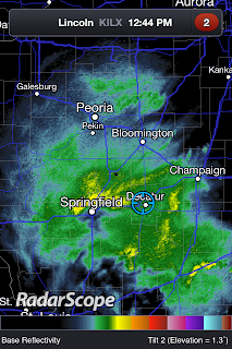
c/o RadarScope

Early Sunday morning the snow began to fill in and by lunchtime was coming down in earnest. Thunder was reported through the afternoon though I never heard it for myself as I was out doing errands before roads got too bad.


Unofficial measuring device with storm total accumulation at my location being 12".

Of all that there was to see on Monday once the storm had cleared, what captured my attention most was that which was deposited by the wind on the south facing top floor balconies.


"Anyone seen Spring?"

More from this event including regional snowfall totals c/o the NWS can be found HERE.

1 comment:
Oh, gosh. We didn't get snow like that where I am! Amazing that you went out and took evening pictures. It must have been quite cold.
Post a Comment