After an extended period of ideal viewing conditions for the 2012 annular eclipse, it would figure that when this historic natural event came to pass, Central Illinois would be socked in with clouds and storms. I made it a point to be out anyways in the hope that there would be a break during the magic moment but there was none. What I did get to see was a severe warned cell coming out of Sangamon into Macon county that produced an impressive down burst dust foot that kicked up a massive amount of dirt since it has been so dry.
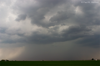
Once all was done with the severe event, I headed south to run an errand even though by now all hope was lost for seeing the eclipse. While down in southern Macon County, I noticed a boundary with a rain shaft behind it that I thought made for a cool composition. This is where it got interesting and frustrating at the same time for I wasn't paying attention that this was a cell rooted on the south side of a stalled boundary. When this occurs, you'll sometimes get photogenic structure as the little bit of directional wind shear sculpts the base. Today I hit the mother lode of non-severe, ofb enhanced base structure yet I was oblivious to what was happening because I was seeing it from the wrong side. In hindsight, I am not 100% certain to have been on the other side facing north would have been ideal for seeing all the crazy motions but I did have a meltdown of sorts when I realized what I was looking at much later and felt completely stupid. I'm sure by now most people think I'm nuts anyways but one truth about me is that I am exceptionally hard on myself. I have my reasons but most notably, for what I lack in forecast ability or being able to follow through like a true over the road chaser, I try to compensate for in accurate identification for which this day I failed.
Moving closer, this is a three shot panorama facing S featuring the back side of the outflow boundary enhanced pulse storm base structure and an interaction that I have only ever seen on radar. The mass is moving from right to left with the cloud streaming into it from the left being a tail cloud.
The mass wrapped into dare I say a "wall cloud" at which point a slowly rotating cigar shaped funnel cloud developed. The whole thing was behaving in the most surreal fashion that you can see in the end video.
Later near Decatur while attempting to photograph the brilliant lightning without much success on what was now a fully mature line producing heavy rain, the area of interest kind of "lined out" yet still was an unusual sight. You are facing E.
Finally near home...


No comments:
Post a Comment