Decatur Illinois USA Photographer, Artist, Weather Observer
Friday, June 25, 2010
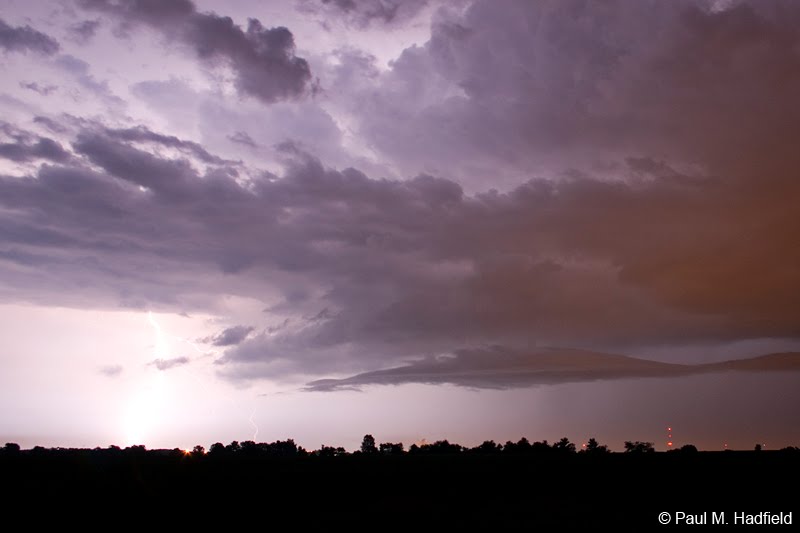
June 23 - Exhausted Squall Line
A very potent weather system the likes of which you might find in April passed through the region this day. A strong jet coupled with incredibly high CAPE values across N IL resulted in a significant damaging wind event across a vast area. Though the tornado threat was considered low, warnings were issued in the Chicago metro with a few confirmed touchdowns. As was expected, storms up N congealed into a powerful squall line that in spite of numerous warnings, lost intensity as it progressed towards the SE. Unlike many who ventured N to experience the worst of this event, I stayed close to home and only stepped out when the line was two counties away. On arrival at my location near Chestnut, a shelf cloud stretching the horizon was immediately followed by gusty outflow winds on the order of 35 MPH tops. Between the darkness of twilight, turbulent cloud bases and the wind rustling the corn, the scene appeared particularly ominous though wasn't. With the collapse of the squall line I was somewhat disappointed but not surprised. An isolated severe cell developing to the W towards Niantic/Illiopolis however, would redeem the outing by offering up a few lightning keepers.
Once this episode concluded, I headed back towards Decatur. Much later around 11 PM and well after the warnings were canceled, an isolated cell developed to the SW of Decatur and drifted over the city. My position enabled for clear S view from which I was treated to the best opportunity of this event.


No comments:
Post a Comment