Saturday, September 04, 2010

September 2 - Severe Weather

On this day a series of strong storms developed in far WC IL and tracked E along the I-72 corridor. Though not posing a significant threat for tornadoes, they did produce numerous wind, hail and heavy rain reports. I headed out in the general direction of Mt. Auburn for an intercept of the first storm then played leap frog back towards the ESE till arriving in S Macon county. Towards dusk, another storm would develop behind the first and be the main player for the day as it passed through Macon county and on into SE IL producing incredible rainfall totals and localized flash flooding. I would find myself underneath this storm and get pummeled by heavy rain and wind making for a very interesting and welcome change to an otherwise stagnant weather pattern with little photographic opportunity. Don't miss the time lapse video link at the end of this blog, skipped embedding as the frame was getting cut off for some reason.


Moving along...


Now at Macon


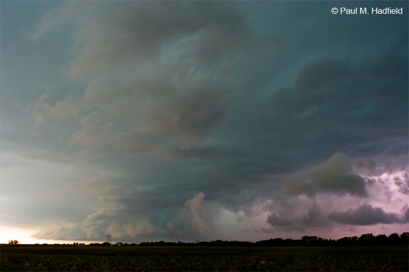
Later at Elwin, I was not able to photograph the short lived lowering appearing as a massive non-rotating wall cloud that was torn apart by downburst winds but managed to make due.


Looking SW at a developing "Charlie" which is meteorological slang for an area of rotation that develops on the SW flank of a mature storm that is back building down a line and interacting with the parent storm outflow.


About to get blasted by strong downburst winds, note the dirt cloud coming at me.


Much later upon passage.


TIME LAPSE VIDEO LINK

1 comment:

Dann Cianca said...

Great photos, man. Glad you're gettin' some action! :)