
After completing a few errands, several cells quickly appeared on radar including a stronger complex coming out of Logan county. Heading north with zero expectations, a dust devil to the NE traveling SE to NW in sync with the surface flow feeding towards the incoming storm was the first item of note.
The complex did not look like much at first but would generate moderate outflow that spun up a vigorous gustnado as seen in the end video. Likewise, it would begin to develop structural characteristics.


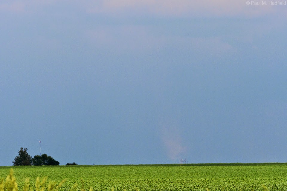
In extreme NE Macon County is where things took a not so fortunate turn for the interesting. By now, confirmed landspouts were occurring up north in Woodford County. Coupled with all that I had observed thus far, upon noticing a stationary plume of dirt under the updraft of this now mature cell, I immediately perceived it too as a spout. Going so far as to notify the weather service and later make mention on social media, it would not be until close examination of video the following day where I would make the embarrassing discovery that a slightly obscured tractor was responsible for the disturbance. False reporting has become an issue now that so many people are involved with weather and the last thing I wish to do is contribute to the problem yet I did just that. Though I followed up with explanation and apology, the damage is done but at least this can serve as an example on what to consider as a possible cause the next time you see a suspicious column on the horizon.


Once the feature dissipated (because the tractor came to a stop), I was still enamored by the structure which has traditionally been my primary focus anyways.

Meanwhile, a second area of interest began to take shape to the immediate west.

Utilizing the only available foreground subject...

It would serve double duty for what now had my full attention.


This area would become less organized however, I would follow and watch as it cycled again with promise but never achieve full potential.


It is worth noting that this is through a wide angle lens so not only is it very broad but also extremely tall.

Despite the mishap, I suppose it's not bad for a day that was only supposed to see garden variety weather.

No comments:
Post a Comment