In spite of a terrible cold at the time of this post and not really feeling it, I didn't want to allow this morning's phenomena to go undocumented. More info on their formation can be found HERE.
The Climate Prediction Center recently released its seasonal outlook update. The strange and mild winter rolls on as seen HERE.
Seems like those mornings I actually have time to do anything, conditions aren't favorable for shooting much of anything. Anyways, while puttering around in the middle of Shelby county till the places I needed to open did...
Later that night I rolled the dice on another solar storm that peaked before the sun went down but aurora forecasting isn't a perfect science so I tried anyways. No luck of course which was no surprise but wasn't going to let the session go to waste without putting something up. Did encounter a half eaten coyote carcass with my flashlight near to where I was shooting that was a tad unsettling.
I don't usually get into discussing other parts of the country but it is safe to say few in the Southern US will forget the January 22nd into the 23rd overnight. Beginning here on Sunday morning, the day started off fairly typical for the year as we saw dense freezing fog around the region. Occurring as result of warm air advecting from the S and interacting with local surface temperatures in the middle 20's, the end product was one of icy tranquility.
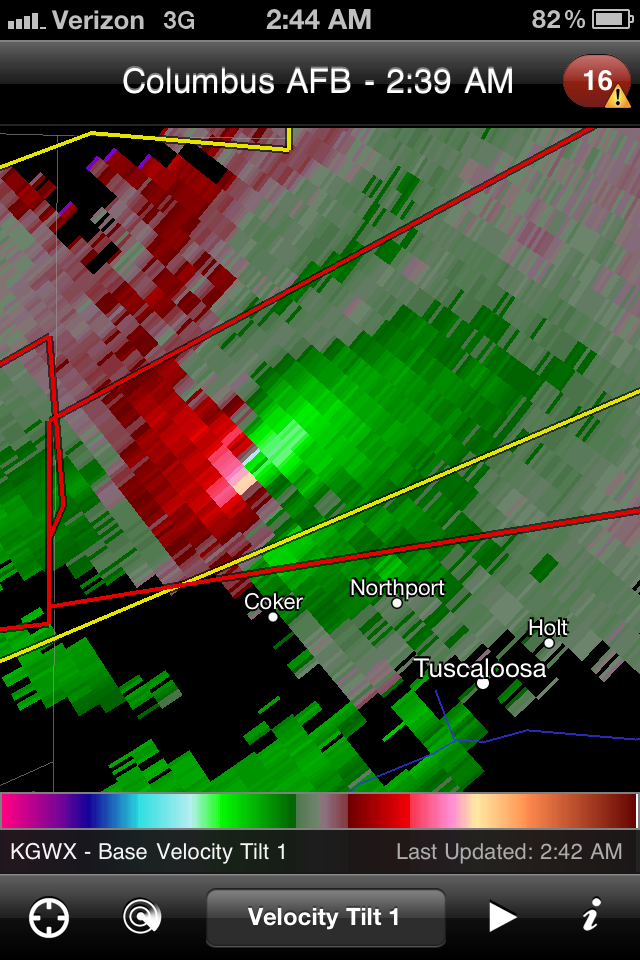
Turning attention towards evening, cells erupting across the deep south quickly went severe and then tornado warned. This particular screen capture shows two mesocyclones with strong rotation and likely producing tornadoes. The dots are storm chaser acquaintances out on Facebook whose well being I was a concerned with at the time. Velocity and reflectivity images are from the RadarScope for iPhone app.
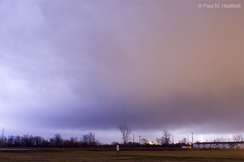
Storms would eventually develop up this way along an advancing squall line but not to the degree of severity as elsewhere. Upon passage of the line and the associated heavy rain, I set up and managed to capture a few of the intense lightning bursts occurring in the stratiform precip region or basically on the backside of the storm. Per the blown out image, I did not see it directly as I was focused elsewhere but for what I did observe, I doubt I would have been able to compensate as it was a multiple return stroke clearly frying something. Radar image is from the time of the shots with my location as blue icon.
Eventually things would quiet down here at which point I turned attention to the ongoing situation in Alabama where unfortunately, numerous violent tornadoes would develop. Those poor people just can't get a break.
Around 7PM while taking out the trash and being peppered by a round of moderate to heavy sleet, Ava and I noticed light pillars occurring as result of the precipitation type so we took off for a better look.
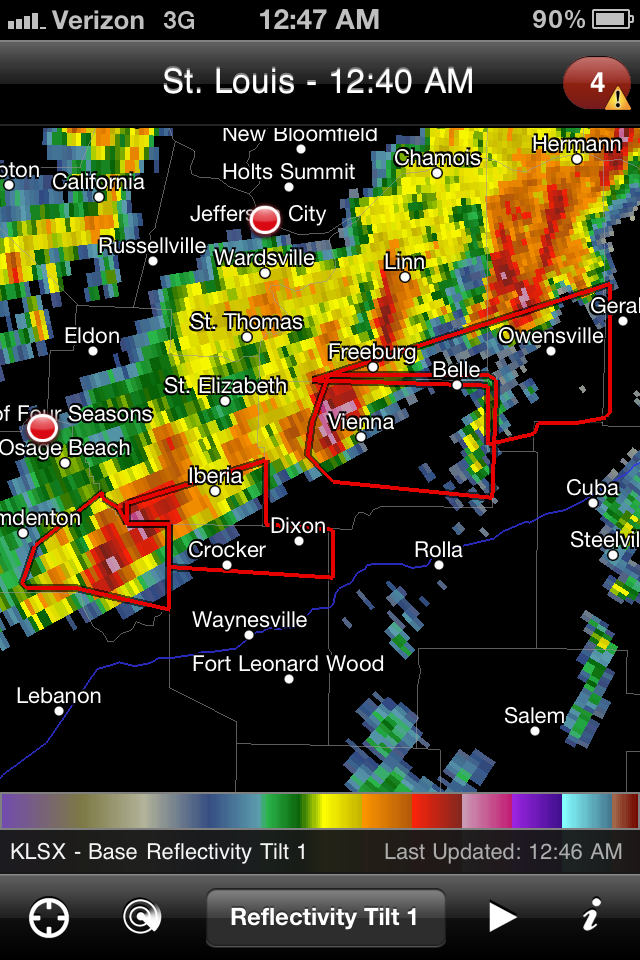
The first US tornado warnings of 2012 occurred in a part of the country one might not expect for the time of year being that of Missouri and eventually into Illinois. The number and intensity was a surprise to those of us who were awake on the overnight watching the event unfold. Up this way we were initially forecast to receive little more than a few rumbles of thunder but ended up with marginally severe storms producing heavy rain, wind, hail and a few regional power outages.
This was the scene in Missouri.
Turning attention towards home, I was at Forsyth and watching radar as we were in the notch of the parent surface low with the warm front extending to my N. As far as position goes, placement was perfect for viewing and experiencing the most intense area were it not for being stuck where I was surrounded by commerce. On passage we were slammed with gusty downburst winds with a measured gust of 47 MPH observed out at the Decatur Airport.
Facing W and shooting continuous, a decent look at the approaching shelf.
Shifting towards the NNW with the shelf nearly overhead.
Time lapse video
Overview after passage of the above scene.
The reflectivity indicative of stronger winds at Harristown would pass over my home which is SW of the icon. Coincidentally my neighbor's dead tree didn't make it through the night though I was unaware at the time I saved the frame.
Throughout the day temperatures plummeted to sub freezing and with it, a few scattered snow showers reminding us that spring is still a long way off.
and finally, would you believe there was an EARTHQUAKE in Illinois today?
Except to get the first picture, I had little interest in stepping out on Thursday due to the intense blizzard-like conditions. Upon doing so however, I encountered a brave group of individuals documenting the latest storm. This came as no surprise since everyone was talking about the weather as it was such a dramatic change from the mild pattern we had been in. Curious as to what they were doing, they invited me to tag along. Midday snow pictures bore me but they insisted I join them so I did.
I was impressed with how well coordinated they were as a team working from both in and out of the vehicle. I guess it comes easy when you have fun with whatever it is that you are doing at the time.
Heading out into the country, the roads weren't too bad although visibility was difficult at times due to blowing and drifting snow. Driving around for the better part of two hours, the bitterly cold -3 wind chill value did a number on me but didn't seem to phase them at all.
Eventually arriving back at home and before parting ways, I asked them how it is that they stay so enthusiastic in the middle of January to which they simply replied "always have fun regardless of circumstance." Keeping this in mind made the faint Light Pillars both over the city and with the moon an easy capture despite a wind chill value of -5.
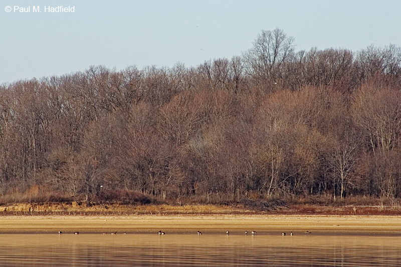
Was somewhat surprised how well these turned out considering all were at great distance. Gull in second image was almost halfway across. Should have gotten a shot of the lake for perspective but was just kind of there to chill. Not much of a chill to be found though.
From 2009, I was at the lower left facing across. Distant marina is same as in second image.